What to do in Maine’s 5 geographic extremes — and where to eat and drink afterward
By Emily Burnham, Bangor Daily News Staff
Mainers definitely have one up on residents of states like Colorado, Wyoming or Kansas. Their states are so square, while ours is among the most irregularly shaped in the country — the National Oceanographic and Atmospheric Administration says our twisty, craggy coastline is technically longer than California’s.
Our river- and ocean-defined borders mean we also have four points that are easily defined as the geographic extremes — the most north, south, east and west — as well as the geographic middle. You can visit all five places, or at least get pretty close to them. Here’s what we suggest you do when you get there.
We didn’t include the highest and lowest points, because the highest point is Katahdin, and the lowest is the Atlantic Ocean, and thankfully there are no restaurants at the mountain’s summit or on the ocean floor.
28527508
North
Do and see: Madawaska is the northernmost town in Maine, but there are several towns that hug the northern border between Maine and New Brunswick that are all pretty far up there. The St. John Valley Heritage Trail was converted from the corridor of the Fish River Railroad, and cuts a flat, easy swath along the St. John River between St. Francis and Fort Kent, for both walkers and cyclists. It’s about 17 miles long, so walking both ways would be time-consuming, but you can park at the municipal office in the village of St. John Plantation for a shorter route. Lushly forested river islands, charming farmlands and views of Canada await the intrepid visitor to this gorgeous corner of the state.
Eat and drink: Storied U.S. highway Route 1 ends in Fort Kent, so it makes perfect sense that the town’s craft brewery would name itself for that famous route — First Mile Brewing. Since 2017, this family-run brewery has offered up classic, easy-drinking pales, wheat beers and IPAs. It’s got a big, comfortable patio and there’s pizza on the weekends. Sounds like a great way to quench your thirst after a nice hike or bike.
23652848
South
Do and see: Tourist hotspots York, Ogunquit and the southernmost point in Maine, Kittery, are overrun all summer. But that doesn’t mean there aren’t still places in the far southern reaches of the state that offer a more relaxed, less crowded experience. Savage Wildlife Preserve in South Berwick offers a short trail with spectacular bird watching opportunities, while Vaughan Woods State Park, also in South Berwick, has several gentle hikes with scenic river views. Make sure you take precautions against ticks!
Eat and drink: Aggie’s Ice Cream, also in South Berwick, doesn’t mess around when it comes to ice cream, with around 100 flavors to choose from on any given day. It’s a throwback to the ice cream stands of our youth — no trendy food fads here, just mountains of sweet, cold ice cream for grownups, kids and, if they’ve been good boys and girls, dogs, too.
15721643
West
Do and see: The westernmost point in Maine is Bowmantown, an Oxford County township that is not accessible by vehicle to the general public and for which permission to enter must be granted by landowner International Paper. Just a few miles south, however, are legendary fishing and paddling lakes Mooselookmeguntic and Aziscohos. Both are beautiful and remote, and offer many opportunities for anglers and for kayakers and canoers. There’s also the Forest Legacy Trail, a network of trails along Mooselookmeguntic and adjacent Cupsuptic Lake, as well as the popular Bald Mountain hike in Oquossoc.
Eat and drink: The Rangeley area became a boomtown last fall, when it saw a big influx of new residents fleeing urban areas because of the pandemic. One of the newest eateries to open in the area is the Portage Tap House, located right in between Mooselookmeguntic and Rangeley Lake. It’s got hearty pub food with lots of vegetarian and vegan options, and a huge craft beer list spotlighting Maine breweries.
25667497
East
Do and see: Everything seems to be the easternmost this, that or the other thing in Washington County, since it’s the easternmost county in the country, with West Quoddy Head Lighthouse being officially the most easterly. Moosehorn National Wildlife Refuge, in Baring and Edmunds, is the easternmost wildlife refuge, naturally, and it’s also an amazing place to look for creatures including moose, bear, beavers and otters, as well as the American Woodcock, the adorable little bird also known as the timberdoodle.
Eat and drink: There’s a wonderful little nexus of cool bars and breweries between Eastport and Lubec. Eastport’s got the newly opened Horn Run Brewing, located in the downtown district and with food trucks regularly visiting on the weekend. In Lubec, there’s Lubec Brewing Company — the easternmost brewery in the U.S. And if you time it right and get a little lucky, you might be able to have a cocktail at the “most absurd bar in the world”: the Hansom House in Dennysville, during its semi-irregular summer hours.
15385627
Right in the middle
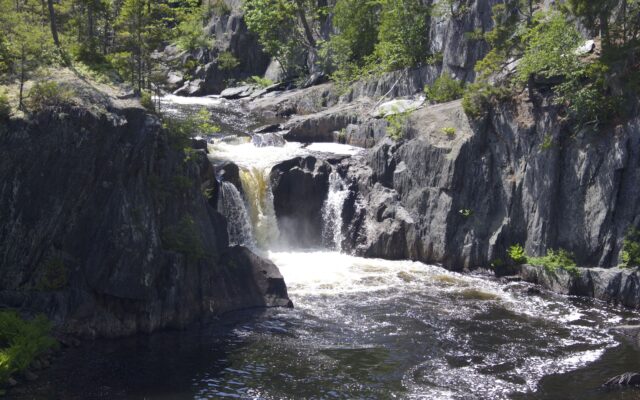
Do and see: The geographic center of Maine is 18 miles north of Dover-Foxcroft, in Piscataquis County — not too far from Katahdin Iron Works and Gulf Hagas, two of Maine’s most beloved sites for both natural and historic beauty. If you haven’t been to either, shouldn’t this be the summer you go?
Eat and drink: A few miles down the road is Bissell Brothers Three Rivers in Milo, the northern outpost for the popular brewery. On the weekends, it’s one of the favorite stops for those adventuring in Maine’s north woods, who drop in for a beer, a bite, and a chance to reflect on all the beautiful stuff they’ve seen that day.